Site Setting and Subsistence: The Local Community, Natural Resources, Prehistoric Climate, and Historic Uses
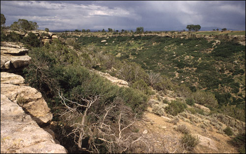 |
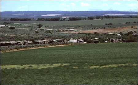
Yellow Jacket Canyon at a point close to the Joe Ben Wheat site complex (SL-YJ-185) |
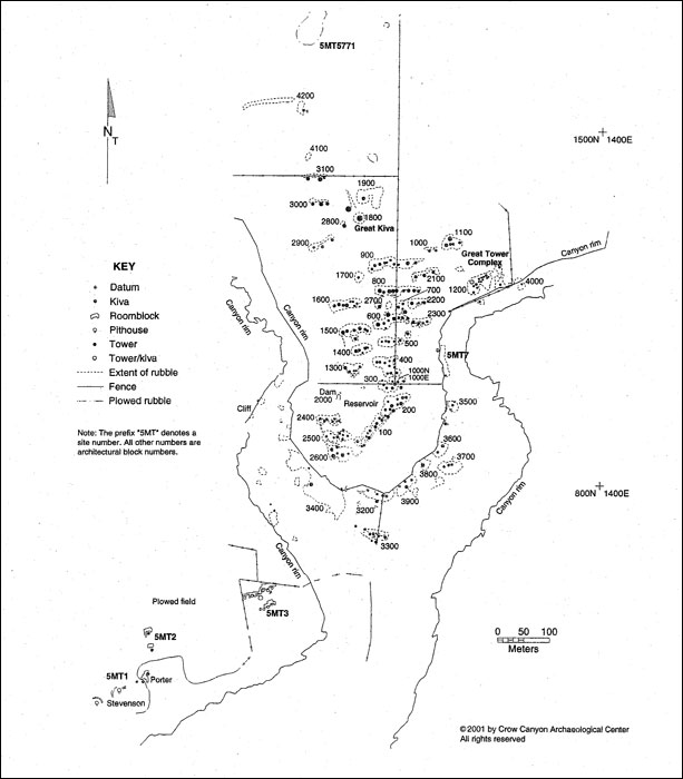 |
Yellow Jacket Locality with Sites 5MT1, 2, 3, and 5. (pdf format). Reproduced with permission of Crow Canyon Archaeological Center. |
Site 5MT2 is part of the Yellow Jacket Community, a cluster of interrelated archaeological sites which are in the heart of the central Mesa Verde region (Varien 2000: Figure 1Varien, Mark D.
2000 Introduction. Kiva 66:5-18.). The sites are on the north side of Yellow Jacket Canyon, approximately 1.2 km downstream from the point where Yellow Jacket Creek becomes an entrenched canyon. The three sites investigated by the University of Colorado Museum's field schools (5MT1, 2 and 3) are separated from a very large site, Yellow Jacket Pueblo (5MT5), by a smaller intermittent drainage named Tatum Draw. Sites 5MT1 and 2 are on the same small ridge and only separated from one another by approximately 25 m. They are so close to one another that some archaeologists might have classified them as a single site. Site 5MT3, a multi-roomblock site with at least 50 rooms, is on a small knoll overlooking Tatum Draw and is approximately 250 m to the northeast of Sites 5MT1 and 2.
The sites are within the larger Monument and McElmo drainage unit, which overall offers a very favorable setting for agriculture and foraging (Adams and Petersen 1999: Table 2-7Adams, Karen R. and Kenneth Lee Petersen
1999 Environment. In Colorado Prehistory: A Context for Southern Colorado Drainage Basin, edited by William D. Lipe, Mark D. Varien, and Richard H. Wilshusen, pp. 14-50. Colorado Council of Professional Archaeologists, Denver.). Additionally, the three sites are only 200 to 500 m from the southwest edge of Yellow Jacket Pueblo (5MT5), the largest known ancestral Pueblo site in the Mesa Verde region (Ortman and others 2000:130-131Ortman, Scott G., Donna M. Glowacki, Melissa J. Churchill, and Kristin A. Kuckelman
2000 Pattern and Variation in Northern San Juan Village Histories. Kiva 66:123-146.). When Wheat began work at 5MT1 and later at 5MT3 he anticipated finding a long occupation sequence at each site, and when Cater began work at 5MT2 in 1986 he also thought that the site occupation might last 200 or more years (Cater 1989Cater, John D.
1989 Chronological Understanding of Site 5MT2, Yellow Jacket, Colorado, and a Study of Abandonment Modes. Unpublished MA thesis, Department of Anthropology, University of Colorado, Boulder.). Based on present information, it appears that the two components of occupation at 5MT2 are more likely limited to between A.D. 1160 to 1280 and so the discussion of social setting and subsistence issues in this chapter will focus on the Pueblo III (A.D. 1150-1300) time period.
By briefly examining the community setting, nearby natural resources, and general pattern of climate change in Pueblo III we can frame some of the key research issues at 5MT2 and place Cater's investigations in a broader context. There will also be a brief review of the historic uses of this area, because they aid in understanding recent site disturbance. More detailed discussions of the local environmental setting can be found in Crow Canyon Archaeological Center's investigations at Yellow Jacket Pueblo (Kuckelman 2003cKuckelman, Kristin A.
2003c Subsistence. In The Archaeology of Yellow Jacket Pueblo (Site 5MT5): Excavations at a Large Community Center in Southwestern Colorado [HTML Title].
Available: http://www.crowcanyon.org/yellowjacket. Date of use: December 17, 2004.) or some of the student theses (e.g., Cater 1989Cater, John D.
1989 Chronological Understanding of Site 5MT2, Yellow Jacket, Colorado, and a Study of Abandonment Modes. Unpublished MA thesis, Department of Anthropology, University of Colorado, Boulder.; Mobley-Tanaka 2005Mobley-Tanaka, Jeanette L.
2005 Community from Within: Intracommunity Interaction and the Social
Formulation of the Yellow Jacket Community, Southwest Colorado, A.D.
1200-1300. Unpublished Ph.D. dissertation, Department of Anthropology, Arizona State University, Tempe.; Stevenson 1984Stevenson, A. J.
1984 A Diachronic Analysis of Chipped Stone Material from Site 5MT3, Yellow Jacket, Southestern Colorado. Unpublished PhD dissertation, Department of Anthropology, University of Colorado, Boulder.; Yunker 2001Yunker, Brian
2001 The Yellow Jacket Burials: An Analysis of Burial Assemblages from Two Basketmaker III through Pueblo III Mesa Verde Area Sites. Unpublished MA thesis, Department of Anthropology, University of Colorado, Boulder.) that have focused on the Yellow Jacket investigations. For more detailed backgrounds on the regional prehistory and social setting go to Lipe, Varien, and Wilshusen's 1999Lipe, William D., Mark D. Varien, and Richard H. Wilshusen
1999 Colorado Prehistory: A Context for Southern Colorado Drainage Basin. Colorado Council of Professional Archaeologists, Denver. review of the region's archaeology or Varien's 1999aVarien, Mark D.
1999a Sedentism and Mobility in a Social Landscape: Mesa Verde and Beyond. University of Arizona Press, Tucson. comprehensive examination of the Mesa Verde region's Pueblo II-III communities. Both Crow Canyon (Connolly 1992Connolly, Marjorie R.
1992 The Goodman Point Historic Land-Use Study. In The Sand Canyon Archaeological Project: A Progress Report, edited by W.D. Lipe, pp. 33-44. Occasional Papers, no. 2. Crow Canyon Archaeological Center, Cortez, Colorado., 1996Connolly, Marjorie R.
1996 Yellow Jacket Oral History Project, Montezuma County, Colorado. Crow Canyon Archaeological Center, Cortez, Colorado. Report submitted to the Colorado Historical Society, Denver.) and the University Museum (Lange and others 1988Lange, Frederick , Nancy Mahaney, Joe Ben Wheat, and Mark L. Chenault
1988 Yellow Jacket: A Four Corners Anasazi Ceremonial Site. Second edition. Johnson Books, Boulder, Colorado.) have produced short summaries of the historic land use in the Yellow Jacket area.
Local Community
Anthropologists have long recognized that the community is one of the most fundamental ways in which households organize themselves to use and reside on local landscapes. A community is made up of a group of households and individuals who typically are in daily contact and who share access to local social and natural resources (see Adler 2002Adler, Michael A.
2002 The Ancestral Pueblo Community as Structure and Strategy. In Seeking the Center Place: Archaeology and Ancient Communities in the Mesa Verde Region, edited by Mark D. Varien and Richard H. Wilshusen, pp. 3-23. University of Utah Press, Salt Lake City. and Varien 1999aVarien, Mark D.
1999a Sedentism and Mobility in a Social Landscape: Mesa Verde and Beyond. University of Arizona Press, Tucson. for more detailed discussions). For the inhabitants at Site 5MT2 the idea of "community" must have included the large village of Yellow Jacket Pueblo that was only 500 m to the west of the site.
Yellow Jacket Pueblo (Plan Map of Yellow Jacket Pueblo - pdf format) was almost continuously occupied between A.D. 1060 and 1280, with the most intensive and extensive occupation deposits representing the A.D. 1180-1260 period (Ortman 2003Ortman, Scott G.
2003 Artifacts. In The Archaeology of Yellow Jacket Pueblo (Site 5MT5): Excavations at a Large Community Center in Southwestern Colorado [HTML Title].
Available: http://www.crowcanyon.org/yellowjacket. Date of use: December 17, 2004.). This is also the primary occupation span of Site 5MT2. At its peak, the population at this single village (5MT5) is estimated to have been somewhere between 850 and 1,360 people (Kuckelman 2003bKuckelman, Kristin A.
2003b Population Estimates. In The Archaeology of Yellow Jacket Pueblo (Site 5MT5): Excavations at a Large Community Center in Southwestern Colorado [HTML Title].
Available: http://www.crowcanyon.org/yellowjacket. Date of use: December 17, 2004.), with between 106 and 170 kivas in use. Given that the latest component of use at 5MT2 has only a single kiva in use and an estimated maximum population of at most 15 to 24 individuals, the nearby village population is about 30 to 50 times larger than that at 5MT2.
Although Yellow Jacket Pueblo must have dominated local community affairs, it is likely that in day-to-day life the nearby hamlet in the Porter area at 5MT1 and possibly the small village of 5MT3, which was only about a quarter kilometer away, would have had much more influence on the household politics at 5MT2. In addition, there is a small unnumbered pueblo just 40 m to the southeast of 5MT2 with an occupation dating between A.D. 1140 and 1225 based on its limited surface assemblage. These two small hamlets (i.e., 5MT1 and the unnumbered pueblo site) are so close to 5MT2 that it is quite possible that the households at the three sites shared kinship bonds, held agricultural land in common, or cooperated on various tasks.
It is intriguing that there is a two or three household pueblo at 5MT1 sometime between A.D. 1120-1200, when Site 5MT2 likely consisted of a single household hamlet, as well as one other possible household at the unnumbered site. In the latest occupations of Sites 5MT1 and 2 at about A.D. 1260, there are an estimated two to three households at 5MT2 when there is most likely a single household at 5MT1. The populations of 5MT1 and 2 appear to grow and wane in inverse relation to one another. It seems likely that the households at sites 5MT1 and 2 must have been tied to one another, but this has not yet been addressed by the Yellow Jacket research.
Undoubtedly Yellow Jacket Pueblo was the largest and densest residential settlement in the Yellow Jacket community during the late Pueblo II and Pueblo III periods. The presence of public architectural features such as a multistory Chacoan great house and at least one great kiva leave little doubt that it was the community's center in the twelfth century. For the two centuries that Yellow Jacket Pueblo persisted as one of the region's great sites, its catchment area is estimated to have grown from 350 sq. km to over 2000 sq. km (Varien 1999a: Tables 7.1-7.3Varien, Mark D.
1999a Sedentism and Mobility in a Social Landscape: Mesa Verde and Beyond. University of Arizona Press, Tucson.). It is evident that Yellow Jacket Pueblo must have exercised an immense influence on the occupation and the ultimate abandonment of 5MT2. The nature of the influence of Yellow Jacket Pueblo on contemporary nearby hamlets such 5MT1 and 2 is one of the most interesting research topics that could be explored in looking at the material culture within the Yellow Jacket collections.
Natural Resources
There are certain natural resources which are essential to establish and maintain a residential site, such as 5MT2. Potable water, agricultural soil, appropriate climate, adequate building materials, abundant wild plant and animal resources, and other specialized items such as potter's clay all are key resources for an ancestral Pueblo settlement in the Mesa Verde region. The Yellow Jacket locale is remarkably well supplied with all these resources, and this in part may have allowed Yellow Jacket Pueblo to have become one of the longest-lived and certainly one of the largest of the Pueblo III villages in the region. The survival of a small hamlet such as 5MT2 certainly must have depended on some sort of pact with or ties to such a large neighboring community center concerning the use of collective natural resources.
[Return to Top]Water
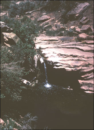 |
Standing water in Tatum Draw, a tributary of Yellow Jacket Creek, just to the east of Site 5MT3 (SL-YJ-274) |
1996 Yellow Jacket Oral History Project, Montezuma County, Colorado. Crow Canyon Archaeological Center, Cortez, Colorado. Report submitted to the Colorado Historical Society, Denver.; Lange and others 1988:14Lange, Frederick , Nancy Mahaney, Joe Ben Wheat, and Mark L. Chenault
1988 Yellow Jacket: A Four Corners Anasazi Ceremonial Site. Second edition. Johnson Books, Boulder, Colorado.); and it is likely they were equally reliable over a thousand years ago. Water would have been vital for cooking, drinking, and cleaning, as well as important in building earthen structures, making pottery clay, and possibly even sustaining some crops.
Water must have become an increasingly scarce resource by at least early Pueblo III because one large reservoir and a number of smaller water control dams were built at Yellow Jacket Pueblo (Kuckelman 2003cKuckelman, Kristin A.
2003c Subsistence. In The Archaeology of Yellow Jacket Pueblo (Site 5MT5): Excavations at a Large Community Center in Southwestern Colorado [HTML Title].
Available: http://www.crowcanyon.org/yellowjacket. Date of use: December 17, 2004.; Wilshusen, Churchill, and Potter 1997: Table 2Wilshusen, Richard H., Melissa J. Churchill, and James M. Potter
1997 Prehistoric Reservoirs and Water Basins in the Mesa Verde Region: Intensification of Water Collection Strategies during the Great Pueblo Period. American Antiquity 62:664-681.). It is possible that the inhabitants of 5MT2 may have created similar smaller water-saving features in nearby drainages, but this cannot be known without additional survey of the local area.
Agricultural Requirements: Soil and Climate
When 5MT2 was first discovered in the 1950s, the site was in a bean field which had recently been put into cultivation. Presently the site area is has reverted to sagebrush and grass, with a few young pinyon and juniper trees taking root. The local soils are characterized by deep eolian-derived soils with some alluvial soils along the canyon rims and in the canyon below the site. The soils surrounding 5MT2 are part of the USDA's Cahona-Sharps-Witt soils mapping complex, with the soils in this locale typically having an upper horizon of 30 cm or so of reddish brown loam and a subsurface argillic horizon extending to up to 160 cm deep and increasingly amounts of calcium carbonate at depth. In the USDA's Soil Taxonomy these soils are fine-silty, mesic Ustollic Haplargids. In everyday language, this means that these soils would have been excellent for prehistoric horticulture, given their ability to hold water, their favorable agricultural soil chemistry, their depth, and their gentle slope with a southeastern aspect. Nearby fields have been in corn, bean, wheat or alfalfa tillage for in some cases over 80 years, which provides at least anecdotal evidence of the agricultural viability of this area.
 |
Fields of cut wheat just to the west of the Joe Ben Wheat site complex (SL-YJ-204) |
1999 Environment. In Colorado Prehistory: A Context for Southern Colorado Drainage Basin, edited by William D. Lipe, Mark D. Varien, and Richard H. Wilshusen, pp. 14-50. Colorado Council of Professional Archaeologists, Denver.). All of these factors make this a relatively promising setting for growing corn.
The components at Site 5MT2 date primarily between A.D. 1160-1280. There are particularly difficult drought periods between A.D. 1130 and 1180 and 1276 and 1299 occupations (Dean and Van West 2002Dean, Jeffrey S. and Carla R. Van West
2002 Environment-Behavior Relationships in Southwestern Colorado. In Seeking the Center Place: Archaeology and Ancient Communities in the Mesa Verde Region, edited by Mark D. Varien and Richard H. Wilshusen, pp. 81-99. University of Utah Press, Salt Lake City.), or essentially at the very beginning and very end of the site occupation. Globally the Little Ice Age began by A.D. 1250 and brought a period of cooler, drier weather to the Four Corners. The prolonged drought of 1276-1299 probably would have caused water tables to fall, which would have exacerbated an already difficult situation and certainly must have been a contributing factor to the Pueblo migration from this area in the late thirteenth century.
Although no study has yet been made of the vegetal remains from 5MT2, there were numerous flotation and bulk soil samples taken, so it should be possible to establish what cultivars and ruderal plants were in regular use at the site. It would be good to compare the macro- and microbotanical evidence from the 5MT2 with that from 5MT5 (Murray and Jackman-Craig 2003Murray, Shawn S. and Nicole D. Jackman-Craig
2003 Archaeobotanical Remains. In The Archaeology of Yellow Jacket Pueblo (Site 5MT5): Excavations at a Large Community Center in Southwestern Colorado [HTML Title].
Available: http://www.crowcanyon.org/yellowjacket. Date of use: December 17, 2004.) to see if the use of fuel, food, and construction materials differed between a small hamlet and a large village.
Wild Plants and Animals
Pinyon and juniper cover the canyon rims and talus just south of the sites and, along with the oak, willow, and reeds of the canyons, would have provided excellent building materials, as well as wood for everything from cradleboards to hoe handles. In addition, various wild berries, ruderal plants such as amaranth, pinyon nuts, some cacti and yucca, as well as various grasses and herbs would have provided excellent resources for food, basketry, cordage, and medicine. As noted before, the vegetal remains have not yet been analyzed. An expert analysis would allow the comparison of the types of plants found in small hamlets such as 5MT1 and 2 with those found in 5MT3 and 5, and would be most informative about how land use and agricultural strategies might differ between large and small sites in the same locale.
Rabbits, mule deer, elk, and semi-domesticated turkey all would have been possible sources of meat, bones for tools, and other household products. A very limited examination of the faunal materials shows there were thousands of animal bones recovered from 5MT2. The majority of the faunal items in the 5MT2 collection were not collected by screening, but even with that limitation, there are sufficient items to allow for some important analyses, especially when combined with larger scale regional studies (e.g., Driver 2002Driver, Jonathan C.
2002 Faunal Variation and Change in the Northern San Juan Region. In Seeking the Center Place: Archaeology and Ancient Communities in the Mesa Verde Region, edited by Mark D. Varien and Richard H. Wilshusen, pp. 143-160. University of Utah Press, Salt Lake City.). A number of pieces of animal bone were fashioned into hide-working or weaving tools.
Geologic Resources
 |
Yellow Jacket Canyon just south of 5MT3, near location of possible clay mines (SL-YJ-194) |
There also are nearby clay deposits on the Yellow Jacket Canyon talus slope just to the southeast of 5MT2 and just south of 5MT3. These clays are of suitable quality to be used in ceramic production (Lange and others 1988:19Lange, Frederick , Nancy Mahaney, Joe Ben Wheat, and Mark L. Chenault
1988 Yellow Jacket: A Four Corners Anasazi Ceremonial Site. Second edition. Johnson Books, Boulder, Colorado.) and raw clays, ceramic production tools, and pottery kilns found at the Yellow Jacket sites lend credence to the idea that much of the pottery at the sites was produced locally. A recent Ph.D. study (Mobley-Tanaka 2005Mobley-Tanaka, Jeanette L.
2005 Community from Within: Intracommunity Interaction and the Social
Formulation of the Yellow Jacket Community, Southwest Colorado, A.D.
1200-1300. Unpublished Ph.D. dissertation, Department of Anthropology, Arizona State University, Tempe.) supports this proposition and compares pottery production and distribution at these smaller settlements and the larger nearby village.
Finally, it is likely that many of the raw materials for the numerous chipped stone tools, pendants, and ground stone implements are locally available, but more detailed analytical studies are needed to confirm this.
Historic Disturbance
 |
Fields to the northeast from 5MT2 (SL-YJ-201) |
 |
Pinto bean fields and Site 5MT1 in the late 1950s (SL-YJ-039) |
1958 A History of Montezuma County: Land of Promise and Fulfillment. Johnson Publishing Co., Boulder, Colorado.). The Forest Service's 1940 black and white aerial photos (CDL 43-49 and 43-50) of this area show Site 5MT2 to be covered with brush and small trees. There are large fields about one mile to the north of this area, but the slightly rougher and sloping terrain close to the canyon probably was less favorable for mechanical cultivation. In 1953 Joe Ben Wheat first heard about the Yellow Jacket sites from the farmer who was clearing the land around Sites 5MT1, 2, and 3. This farmer, Hod Stevenson, had dug for pots on his own land and in a number of other sites about two to three miles east of the Yellow Jacket sites. It appears that about two thirds of the approximately 50 nearly whole vessels he donated to the Museum in 1954 and 1970 were from either his Yellow Jacket property or 5MT5.
Based on 1:20,000 black and white 1950 aerial photos of this locale (DKQ-2-153 and 154) it is evident that 5MT2 had been recently cleared of trees and brush and the area surrounding the roomblocks and kivas plowed at least once with a "one-way" or possibly a special clearing plow. It is likely that no crop was planted in 1951, because that year was so dry in this area that some fields were never planted, and those that were planted almost all failed (Connolly 1992Connolly, Marjorie R.
1992 The Goodman Point Historic Land-Use Study. In The Sand Canyon Archaeological Project: A Progress Report, edited by W.D. Lipe, pp. 33-44. Occasional Papers, no. 2. Crow Canyon Archaeological Center, Cortez, Colorado.). Regular plowing of the area surrounding the site began by at least 1953, but the two main structural areas at 5MT2 were avoided because of the large rock used in the roomblocks. It was common practice for farmers to plow around these higher roomblock areas to avoid damaging their farm equipment. Originally the area surrounding the site was in bean cultivation, but at least since the 1980s it has been used to grow alfalfa or been in a crop reduction program.
Conclusions
Site 5MT2 was the last of the Yellow Jacket sites to be investigated by the University Museum, but despite that fact it was relatively undisturbed by modern agricultural practices. The site setting would have had plentiful resources for early horticulturalists. However, the small ridge where the site is located probably limited the growth of the population to no more than a handful of households. Small drainages and sloping hillsides to the east and west and a large canyon to the south hemmed in the settlement. The very aspects which made it a favorable setting for a multiple household pueblo also probably limited the size of this settlement, especially after the establishment of much larger nearby sites such as 5MT3 and 5MT5, which were probably better able to lay claim to available local resources.